Location: Newport, Pembrokeshire
Days since departure: 29
Days walked: 25
Mileage (planned): 363
Mileage (actual): at least 391
Counties visited: 7
Blisters: 5 – but they’re not hurting any more… fingers crossed!
OK, so (remarkably) it turns out I can walk faster than I can write. This blog is essentially a month out of date – sorry! Still having major trouble with phone signal, it’s pretty much non-existent for much of the route I’ve covered so far. So I’ll do my best to recount things in some sort of chronological order, but you might have to wait until December for me to catch up with July!
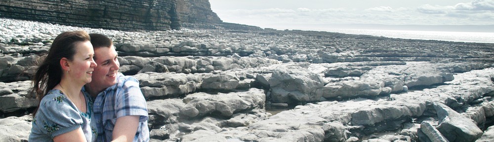
Having brought the pack weight down to a manageable level, the first few days’ walk went well. The weather was kind over the rest of the weekend, and Tasha walked with me through Day 2, which took us as far as St Donats in the Vale of Glamorgan. On the way we met up with the Ramblers again – this time on their way around Barry Island in the opposite direction to us – and with Steve Webb (DragonWalk2012 – he’ll be following my route later this year but starting in North Wales) and his other half Liz. Steve knew where to meet me thanks to my tracker which has mostly worked very well – more on that later. We stopped for a photo outside that cafe off of Gavin & Stacey, cue (actually quite convincing) Nessa impressions by Tasha.
By this time I’d already had my first navigational mishap – I wandered a long way down Dock Road instead of staying up on the clifftop on the eastern end of Barry Island, and ended up having to backtrack from a dead end (up a steep hill). It did mean I got to tick off an extra lifeboat station though – I seem to be collecting them, along with lighthouses.
Next stop was Porthkerry Country Park, which has a great viaduct and an excuse for an icecream – first one of the walk!

Ice cream #1 - Porthkerry Country Park
Whilst I was eating this we got chatting to a family on the next table, who seemed really enthusiastic and donated £15! Set off feeling pretty positive about things after that!
We stopped next for lunch at Rhoose Point – the southernmost point of Wales and the first ‘-most point’ in the bag! Just west of here there’s some gravel pits where someone has made lots of swirly patterns in the gravel – you can see them on Google Earth.
A bit further west again is the power station at East Aberthaw. It’s a massive site and really dominates the skyline for a mile or so; it also has a pretty substantial sea wall and quite a lot of what I guess must be World War II remnants nearby – tank traps and pillboxes on the pebble beach. Probably one of the best defended power stations in the UK – if Dorset decides to invade I suggest an amphibious landing at Barry Island instead…
Unfortunately we encountered an even more effective obstacle at Gileston Farm, just inland from Aberthaw. The marked (and published) Wales Coast Path route passes through the farm and along a track through fields to the west – this saves a long walk over the enormous pebbles on the shoreline, which are pretty hard going. When we got into the farm yard we were nabbed by a farmer in a tractor who insisted that the correct route was back down the road and along the beach.
“Where do you think you’re going?”
“Along the Wales Coast Path, hopefully. We followed the waymarker over there.”
“Nah, it’s not that way, and anyway, you won’t get through cos it’s knee deep in s#*t.”
After the tractor disappeared, another younger and more helpful farm bloke turned up and admitted that, yes, the path does go that way, but “we’ve got a problem with it and it’s, er, a bit mucky”. He gave us some pointers about following the hedge through the field rather than on the track, and headed off too.
Out of the farm yard and into… slurry. Literally a foot deep, black and stinking, and running in a deep tide across the entire track and out through the hedges into the field for about 100 yards. Even with some carefully thought-out detouring, we couldn’t avoid all of it and had to wade through for a few yards – fortunately it didn’t quite come over the tops of our boots, but they were completely covered afterwards.
I won’t speculate as to how it got onto the track, except to say that we saw no sign of a slurry tank (leaky or otherwise) anywhere near the route…
The rest of the day was less eventful and at the end of it we were generously accommodated in a flatlet at UWC Atlantic College, who had also allowed us to park Tasha’s car there for a couple of days so that she could get home afterwards! The college, which teaches the International Baccalaureate to students from around the world, is based in a fantastic 12th-century castle and places a strong emphasis on community service – including having its own RNLI inshore rescue boat station which is manned by the students. The College and its founding headmaster Rear Admiral Dennis Hoare played a major role in the development of the Rigid Inflatable Boat (RIB) which is the most widely used type of inshore rescue craft.
As I’ve been writing this, I’ve been sat in Frankie & Benny’s in Carmarthen, taking advantage of the free wifi. Sadly time’s up as Tasha and I need to get back to north Pembs and zip up the tent before tonight’s forecast storms :-S
What am I doing in Carmarthen? Well, after a month of walking my first pair of boots has already given up on me, splitting at the toe flex point and letting in lots and lots of water – after a rainy day on Thursday my feet looked like I’d been in the bath all day! So we’ve popped back to Carmarthen on my rest day to pick up a replacement pair from the Cotswold store. Fingers crossed this pair will be a bit tougher! All credit to Scott at the Talbot Green store and to Tom at Carmarthen for making the swap completely hassle free even though my receipt is back at home in Caerphilly – thanks chaps.
Next update as soon as I can manage it – thanks for your patience everyone!